


Edition:
  • Global (English, INR)
  • 🇺🇸 United States
  • 🇬🇧 United Kingdom
  • 🇩🇪 Germany
  • 🇫🇷 France
  • 🇺🇦 Ukraine
  • 🇵🇱 Poland
  • 🇦🇪 United Arab Emirates
  • 🇪🇬 Egypt
  • 🇦🇺 Australia
  • 🇨🇦 Canada
  • 🇧🇷 Brazil
  • 🇯🇵 Japan
  • 🇹🇷 Turkey
  • 🇪🇸 Spain
  • 🇮🇹 Italy
  • All 15 country editions
Currency:
  • INR ₹ · India
  • USD · United States
  • GBP · United Kingdom
  • EUR · Germany
  • UAH · Ukraine
  • PLN · Poland
  • AED · United Arab Emirates
  • EGP · Egypt
  • AUD · Australia
  • CAD · Canada
  • BRL · Brazil
  • JPY · Japan
  • TRY · Turkey
  • More currencies
  • Request Demo
  • Export Markets
  • Insights

Counter-UAS & defense systems, made in India

Facebook X (Twitter) LinkedIn

Call +91 6375729997 · WhatsApp

FlySpark unmanned ground and surface vehicles
FlySpark
  • About FlySpark
  • Products
  • Export Markets
  • Insights
  • App
  • Contact
+91 6375729997
[email protected]
Head office

E-317, Siddhraj Z-Square Podar International School Road, Kudasan, Gandhinagar, Gujarat – 382421, India

FlySpark HQ

Mon – Sun · 19:30 – 03:30 IST

© 2014–2026 FlySpark. All rights reserved.

FlySpark
Shop by category
  • Counter-UAS & Anti-Drone Defense
  • Drone Detection, Radar & Surveillance
  • Tactical UAV & FPV Drone Systems
  • Long-Endurance VTOL & Heavy-Lift UAVs
  • Military Heavy-Lift & Large-Payload UAVs
  • Secure Communication, Fiber Optic & Tethered Systems
  • UAV Propulsion, Powertrain & Components
  • Command, Control & Robotics
  • Unmanned Ground & Surface Vehicles (UGV / USV)
  • UAV Payload Droppers & Release Systems
  • Home
  • Products
    Counter-UAS
    • Counter-UAS & Anti-Drone Defense
    • Drone Detection, Radar & Surveillance
    UAV platforms
    • Tactical UAV & FPV Drone Systems
    • Long-Endurance VTOL & Heavy-Lift UAVs
    • Military Heavy-Lift & Large-Payload UAVs
    Systems & robotics
    • Command, Control & Robotics
    • Unmanned Ground & Surface Vehicles (UGV / USV)
    • Secure Communication, Fiber Optic & Tethered Systems
    Components & payloads
    • UAV Propulsion, Powertrain & Components
    • UAV Payload Droppers & Release Systems
    FlySpark counter-UAS systems
    Counter-UAS
    Detect, jam & defeat
    Explore
  • Markets
  • Insights
  • App
  • About
  • Contact
Cart 0
Account 
  • Sign in
  • Register
  • Cart
  • Request Demo

Search FlySpark products

Talk to the FlySpark Export Desk

Get specifications, pricing in your currency and lead times — the FlySpark export desk typically replies within 24 hours. Prefer chat? WhatsApp us.

Request a quote or demo by email

Guardian-X close-range interceptor drone
N-Defender passive drone detection system locking a target
HD-2 portable anti-drone detection system
TK2100 tracked UGV wading through water
SeaScout S8 uncrewed surface vessel on port security patrol
High-speed FPV interceptor drone in flight
FlySpark

Defense-grade counter-UAS, detection and tactical UAV systems for authorized programs.
ANUSHAKTI INFOTECH PRIVATE LIMITED · GST 24ABCCA1331J1Z5 · CIN U46520GJ2025PTC158699

Facebook X (Twitter) LinkedIn

Products

  • Counter-UAS Systems
  • Drone Detection
  • Fiber & Secure Comms
  • Propulsion & Components
  • Tactical UAV & FPV
  • Payload Droppers

Company

  • About Us
  • Contact
  • Export Markets
  • Technical Insights
  • App
  • Downloads
  • Insights RSS

Legal & Policies

  • Privacy Policy
  • App Privacy Policy
  • Terms of Service
  • Disclaimer
  • Shipping Policy
  • Refunds & Returns
  • Cookie Policy

Need Help?

Head office: E-317, Siddhraj Z-Square Podar International School Road, Kudasan, Gandhinagar, Gujarat – 382421, India

Tel: +91 6375729997
WhatsApp: +91 6375729997
Email: [email protected]
Mon – Sun · 19:30 – 03:30 IST

Copyright © 2014–2026 FlySpark. All rights reserved.

  • Country editions · local price & language:
  • 🇺🇸 United States
  • 🇬🇧 United Kingdom
  • 🇩🇪 Germany
  • 🇫🇷 France
  • 🇺🇦 Ukraine
  • 🇵🇱 Poland
  • 🇦🇪 United Arab Emirates
  • 🇪🇬 Egypt
  • 🇦🇺 Australia
  • 🇨🇦 Canada
  • 🇧🇷 Brazil
  • 🇯🇵 Japan
  • 🇹🇷 Turkey
  • 🇪🇸 Spain
  • 🇮🇹 Italy
  • All 15 country editions →
  1. Home
  2. Command, Control & Robotics
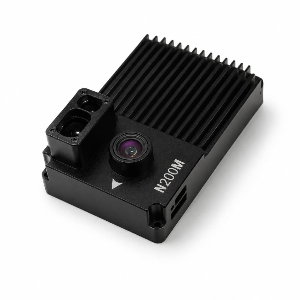
  3. FlySpark N200M GPS-Free VIO Navigation Module | AI Visual-Inertial Navigation Camera for UAV, FPV Drone & GPS-Denied Flight
FlySpark N200M GPS-Free VIO Navigation Module | AI Visual-Inertial Navigation Camera for UAV, FPV Drone & GPS-Denied Flight — view 1
FlySpark N200M GPS-Free VIO Navigation Module | AI Visual-Inertial Navigation Camera for UAV, FPV Drone & GPS-Denied Flight — view 2
FlySpark N200M GPS-Free VIO Navigation Module | AI Visual-Inertial Navigation Camera for UAV, FPV Drone & GPS-Denied Flight — view 3
FlySpark N200M GPS-Free VIO Navigation Module | AI Visual-Inertial Navigation Camera for UAV, FPV Drone & GPS-Denied Flight — view 4
FlySpark N200M GPS-Free VIO Navigation Module | AI Visual-Inertial Navigation Camera for UAV, FPV Drone & GPS-Denied Flight — view 5
FlySpark N200M GPS-Free VIO Navigation Module | AI Visual-Inertial Navigation Camera for UAV, FPV Drone & GPS-Denied Flight — view 6
FlySpark N200M GPS-Free VIO Navigation Module | AI Visual-Inertial Navigation Camera for UAV, FPV Drone & GPS-Denied Flight — view 7
FlySpark N200M GPS-Free VIO Navigation Module | AI Visual-Inertial Navigation Camera for UAV, FPV Drone & GPS-Denied Flight — view 8
Command, Control & Robotics

FlySpark N200M GPS-Free VIO Navigation Module | AI Visual-Inertial Navigation Camera for UAV, FPV Drone & GPS-Denied Flight

check_circleIn stock
FlySpark

FlySpark N200M GPS-Free VIO Navigation Module | AI Visual-Inertial Navigation Camera for UAV, FPV Drone & GPS-Denied Flight — available for export to United Kingdom. Indicative price £1,620 (GBP, ex-works). Formal quote, lead time and end-user documentation on WhatsApp.

Base price — FlySpark N200M GPS-Free VIO Navigation Module - Standard Unit
£1,620≈ US$2,165
Indicative ex-works price converted from INR (rates 2026-10-31). Final quote issued in GBP on WhatsApp/email.

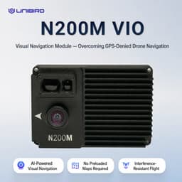
FlySpark N200M GPS-Free VIO module gives UAVs visual-inertial navigation, stable hover, takeoff and route support without GPS signals.

Configuration : FlySpark N200M GPS-Free VIO Navigation Module - Standard Unit

Orders are confirmed by our sales desk on WhatsApp with a quote in GBP.

Qty
chatGet Quote on WhatsApp
mail_outlineRequest Quote by Email
descriptionRequest PDF datasheet
verified_user

Military-grade quality assured

lock

Export-compliant documentation

headset_mic

24/7 engineering support

Talk to sales

phoneCall us now +91 6375729997chatWhatsApp

Mon – Sun · 19:30 – 03:30 IST · [email protected]

FSP-N200M-VIO-STD
Active
7
134
  • Home
  • Command, Control & Robotics
  • flyspark
  • n200m
  • n200m-vio-module
  • gps-free-navigation-module
  • vio-navigation-module
  • visual-inertial-odometry
  • visual-navigation-module
  • ai-visual-navigation
  • drone-navigation-module
  • uav-navigation-module
  • fpv-drone-navigation
  • gps-denied-navigation
Share
  • LinkedIn
  • Email
  • Copy link
  • Mission overview
  • Mission configurations7
  • Technical specifications
  • FAQ

Key facts

At a glance

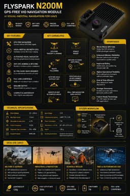
The FlySpark N200M is a visual-inertial odometry (VIO) navigation module for drones that need to hover, take off, land and follow routes when GPS/GNSS is unavailable or unreliable. It fuses a downward camera view of ground texture with inertial data and laser or LiDAR height, needs no preloaded maps, and outputs navigation data over MAVLink to PX4 or ArduPilot (APM) flight controllers. FlySpark lists a 30–200 m operating altitude, up to 15 m/s flight speed, 30 Hz output, 12 V / 7 W power and a 128 g weight, at £1,620

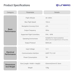
FlySpark N200M GPS-Free VIO Navigation Module | AI Visual-Inertial Navigation Camera for UAV, FPV Drone & GPS-Denied Flight — key specifications
Navigation methodVisual-inertial odometry (camera + IMU + laser/LiDAR height)
Recommended flight altitude30–200 m
Maximum flight speed15 m/s
Output frequency30 Hz
Navigation accuracy≤5% (listed)
Output protocolMAVLink
Supported flight controllersPX4 / APM (ArduPilot)
Communication interfaceUART, TTL 3.3 V
Input voltage12 V (regulated)
Power consumption7 W
Dimensions92 × 62 × 37.3 mm
Weight128 g
Night operationNot supported yet; daylight / visible-scene use recommended
Price£1,620, standard unit

Use cases

  • GPS-denied or GNSS-jammed UAV navigation and hover hold
  • Route following without satellite lock
  • Industrial and infrastructure inspection where GNSS is unreliable
  • Anti-jamming navigation resilience testing
  • Drone R&D and university navigation labs

Standards & references

  • MAVLink protocol — The N200M outputs its navigation data as MAVLink messages to the flight controller.
  • PX4 Autopilot — One of the two flight-controller firmware families FlySpark lists as supported.
  • ArduPilot Copter — ArduPilot (APM) is the other firmware family FlySpark lists as supported.

Sources: FlySpark catalog data (product description and specifications); MAVLink developer guide; PX4 user guide; ArduPilot Copter documentation. Updated 12 Oct 2026.

Intelligence Brief

Mission overview

FlySpark N200M GPS-Free VIO Navigation Module | AI Visual-Inertial Navigation for UAVs

The FlySpark N200M GPS-Free VIO Navigation Module is an AI visual-inertial navigation system designed for UAVs, FPV drones, industrial drones and R&D platforms that need stable navigation when GPS/GNSS is unavailable, jammed, spoofed, blocked or unreliable. Using Visual-Inertial Odometry, the module combines downward visual sensing, IMU-based motion data, flight-controller attitude data and laser ranging to estimate drone motion and maintain positioning without depending on satellite signals.

N200M is built for GPS-free takeoff, landing, stable hover, route following and navigation support in unfamiliar environments without preloaded maps. It analyzes visual frame changes and ground texture in real time, fuses inertial data and outputs navigation information through MAVLink for compatible PX4 / APM flight controllers.

The module supports 30m–200m flight altitude, up to 15m/s flight speed, 30Hz output frequency, ≤5% listed navigation accuracy, UART TTL 3.3V communication, 12V input, 7W power consumption, 92mm × 62mm × 37.3mm dimensions and 128g weight. It is suitable for professional UAV integration where reliable GPS-free hover, visual positioning and navigation resilience are required.

  • PRODUCT POSITIONING:
  • AI GPS-Free Drone Navigation Module:
  • • Visual-Inertial Odometry navigation module
  • • Designed for GPS-denied and GNSS-challenged drone operation
  • • Supports GPS-free takeoff, landing and stable hover
  • • Enables route-following support without relying on satellite positioning
  • • Uses AI visual navigation and inertial data fusion
  • • Uses camera + IMU + LiDAR / laser ranging workflow
  • • No preloaded maps required
  • • Compatible with PX4 / APM flight controllers
  • • MAVLink output protocol
  • • Lightweight 128g module
  • • 30Hz navigation output
  • • Designed for UAV, FPV drone, industrial drone and R&D integration
  • Core Value:
  • • Keeps drone stable when GPS is unavailable
  • • Improves navigation reliability in interference-prone environments
  • • Reduces dependency on satellite signals
  • • Supports visual positioning using ground texture
  • • Helps maintain hover and route behavior in GPS-denied zones
  • • Works as a plug-and-fly navigation upgrade for supported flight controllers
  • • Provides a compact, low-power navigation layer for custom UAV platforms
  • BEST USE CASES:
  • • GPS-denied UAV navigation
  • • FPV drone GPS-free hover support
  • • UAV route following without satellite lock
  • • Industrial inspection drones
  • • Defense and security UAV platforms under lawful use
  • • Drone R&D and flight-control testing
  • • Indoor/outdoor transition research where GPS is weak
  • • Infrastructure inspection where GNSS is unreliable
  • • Mountain, valley, urban canyon or under-interference flight testing
  • • Anti-jamming navigation resilience testing
  • • Autonomous drone development
  • • Mapping and surveying support where GPS signal is unstable
  • • Training and educational UAV navigation labs

IMPORTANT USE NOTE: This is a drone navigation component intended for lawful UAV operation, professional integration, R&D, inspection, security, industrial and authorized defense use. It must not be used for unlawful surveillance, unsafe autonomous operation, weaponization, privacy violation or aviation-rule violations. Drone operation must follow DGCA/local aviation rules, site permissions, privacy regulations, RF regulations and safe operator procedures. Performance depends on ground texture, lighting, altitude, vibration, flight speed, camera visibility, calibration and flight-controller integration.

FREQUENTLY ASKED QUESTIONS:

Q: What is the FlySpark N200M GPS-Free VIO Navigation Module?

A: FlySpark N200M is a Visual-Inertial Odometry navigation module for drones. It helps UAVs maintain positioning, hover and navigation behavior without relying on GPS signals.

Q: What is the price of FlySpark N200M?

A: The listed price is £1,620 for the standard N200M GPS-Free VIO Navigation Module.

Q: What does VIO mean?

A: VIO stands for Visual-Inertial Odometry. It estimates motion by combining visual camera information with inertial sensor data.

Q: What is the purpose of this module?

A: The purpose is to support GPS-free drone navigation, stable hover, takeoff, landing and route-following behavior in GPS-denied or GPS-degraded environments.

Q: Does this module need GPS?

A: No. It is designed to operate without depending on GPS for local visual-inertial positioning.

Q: Can it work when GPS is jammed?

A: Yes, the module is designed for GPS-denied and interference-prone environments because it uses visual-inertial navigation rather than satellite positioning.

Q: Can it work when GPS is spoofed?

A: It can improve resilience against GPS spoofing because the local navigation solution is based on visual and inertial sensing instead of trusting spoofed GNSS coordinates.

Q: Does it require preloaded maps?

A: No. It is designed for map-free navigation and can operate in unfamiliar areas using ground texture and sensor fusion.

Q: What sensors are used?

A: The system uses visual camera sensing, IMU/inertial data, flight-controller attitude data and laser ranging / LiDAR-based height support.

Q: Does it include an AI camera?

A: Yes. It uses AI visual navigation with a camera-based visual sensing workflow.

Q: What flight altitude is supported?

A: The listed flight altitude range is 30m–200m.

Q: What is the maximum supported flight speed?

A: The listed maximum flight speed is 15m/s.

Q: What is the listed navigation accuracy?

A: The listed navigation accuracy is ≤5%, depending on environment and installation conditions.

Q: What is the output frequency?

A: The navigation output frequency is 30Hz.

Q: What flight controllers are supported?

A: PX4 and APM flight controllers are listed as supported.

Q: What output protocol does it use?

A: It uses MAVLink output protocol.

Q: What communication interface does it use?

A: It uses UART TTL 3.3V communication.

Q: What input voltage is required?

A: The listed input voltage is 12V.

Q: What is the power consumption?

A: The listed power consumption is 7W.

Q: What are the module dimensions?

A: The module dimensions are 92mm × 62mm × 37.3mm.

Q: What is the module weight?

A: The module weight is 128g.

Q: Does it support night operation?

A: The listed operating note says night scene is not supported yet. It is best used where the camera can clearly see ground texture.

Q: What type of ground is best for performance?

A: Ground with visible texture, contrast and identifiable visual features gives the best performance.

Q: What type of ground can reduce performance?

A: Featureless surfaces, water, snow, plain sand, darkness, heavy dust, fog, glare or visually uniform terrain can reduce performance.

Q: Is this a complete drone?

A: No. It is a navigation module / drone component for integration into a compatible UAV platform.

Q: Is it suitable for FPV drones?

A: Yes. It can be used with compatible FPV drone platforms where flight-controller integration, mounting and power requirements are satisfied.

Q: Is it suitable for industrial drones?

A: Yes. It is suitable for inspection, monitoring, R&D and GPS-resilient UAV platforms.

Q: Is it suitable for defense and security drones?

A: Yes, only under lawful and authorized use. It can support navigation resilience where GPS/GNSS signals are unreliable.

Q: Does it replace all GPS functions?

A: It supports GPS-free local navigation and positioning behavior, but it should not be treated as a universal replacement for all global coordinate navigation use cases.

Q: Does it need calibration?

A: Proper installation, flight-controller configuration, vibration control and test flights are required. Site-specific testing is recommended.

Q: Can it perform autonomous route following?

A: It can support route-following behavior through compatible flight-controller configuration, but final performance depends on autopilot setup and flight mode.

Q: Can it help with return-to-home without GPS?

A: It can support GPS-free navigation workflows, but exact return behavior depends on flight-controller configuration, mission setup and integration method.

Q: Is it plug-and-fly?

A: It uses standard MAVLink interfaces and is designed for quick integration with supported UAV platforms, but professional setup and validation are still recommended.

Q: What makes it useful in GPS-denied environments?

A: It does not depend on satellite signals for local positioning. It uses visual frame changes, inertial data and laser ranging to estimate motion and support stable flight.

Q: What are the main limitations?

A: It requires visible ground texture, proper lighting, stable mounting, compatible flight controller and correct configuration. Night scene is not supported yet.

Q: Can it be used indoors?

A: It may support GPS-free positioning concepts where visual features and altitude requirements are suitable, but the listed altitude range is 30m–200m, so final suitability depends on the actual flight environment.

Q: Does it transmit RF?

A: No. It is a navigation sensing module and does not function as an RF transmitter or jammer.

Q: Is it a GPS jammer or GPS spoofer?

A: No. It is a GPS-free visual-inertial navigation module. It does not jam or spoof GPS.

Q: What is included in the standard package?

A: Standard package scope depends on supply configuration, but the key product is the FlySpark N200M navigation module with integration support as required.

Q: Can FlySpark provide integration support?

A: Yes. FlySpark / AnuShakti Infotech Pvt. Ltd. can provide integration support for approved projects.

Q: What legal precautions are required?

A: Users must follow aviation rules, site permissions, privacy rules and safe UAV operating procedures. It must not be used for unlawful surveillance, unsafe autonomous flight or harmful operations.

Q: What warranty is included?

A: Warranty support is 1 Year for manufacturing defects under approved integration and normal operating conditions. Damage from wrong power input, crash, vibration damage, water ingress, overheating, unauthorized modification or misuse may not be covered.

Mission configurations

Configuration (7)

Select your operational configuration. Pricing may vary — request a formal quote for deployment quantities.

Standard FlySpark N200M GPS-free VIO navigation module for supported UAVs and FPV drone platforms requiring visual-inertial navigation in GNSS-denied or GPS-degraded environments.

SKU: FSP-N200M-VIO-STD

Unit Price (GBP, ex-works)£1,62010 units

Standard N200M module with PX4-focused wiring review, MAVLink port guidance, mounting guidance, flight-mode compatibility review and setup checklist. Recommended for PX4 drones, Pixhawk-class flight controllers and UAV R&D platforms.

SKU: FSP-N200M-VIO-PX4

Unit Price (GBP, ex-works)POAAvailable

Standard N200M module with APM / ArduPilot-style flight-controller integration review, UART/MAVLink connection guidance, mounting guidance and basic tuning checklist.

SKU: FSP-N200M-VIO-APM

Unit Price (GBP, ex-works)POAAvailable

Standard N200M module with GPS-denied flight planning checklist, environment assessment, texture/lighting suitability review, mounting support and safe test-flight workflow.

SKU: FSP-N200M-VIO-GPS-DENIED

Unit Price (GBP, ex-works)POAAvailable

Standard N200M module with inspection-drone integration support, stable-hover configuration checklist, vibration-control advice and site-use planning for powerline, refinery, bridge, mining and infrastructure inspection.

SKU: FSP-N200M-VIO-INSPECTION

Unit Price (GBP, ex-works)POAAvailable

Standard N200M module with technical integration support, MAVLink workflow review, test-flight checklist, lab documentation and developer guidance for UAV labs and researchers.

SKU: FSP-N200M-VIO-RD

Unit Price (GBP, ex-works)POAAvailable

Standard N200M module with operator orientation, installation review, performance-limit explanation, safe-use checklist, maintenance guidance and deployment SOP support.

SKU: FSP-N200M-VIO-TRAINING

Unit Price (GBP, ex-works)POAAvailable

Active configuration

FlySpark N200M GPS-Free VIO Navigation Module - Standard Unit

Standard FlySpark N200M GPS-free VIO navigation module for supported UAVs and FPV drone platforms requiring visual-inertial navigation in GNSS-denied or GPS-degraded environments.

£1,620

GBP · indicative ex-works

SKU: FSP-N200M-VIO-STD

Configuration matrix

Compare all variants

Side-by-side specifications — click a column to select

Parameter
Unit Price (GBP, ex-works)£1,620POAPOAPOAPOAPOAPOA
Stock10 unitsAvailableAvailableAvailableAvailableAvailableAvailable
SKUFSP-N200M-VIO-STDFSP-N200M-VIO-PX4FSP-N200M-VIO-APMFSP-N200M-VIO-GPS-DENIEDFSP-N200M-VIO-INSPECTIONFSP-N200M-VIO-RDFSP-N200M-VIO-TRAINING

Technical Data Sheet

System Specifications

134 parameters across 16 categories

search

straightenPhysical7 fields

Weight
128g
Form Factor
Compact drone-mounted navigation module
Mounting Position
Downward visual field of view required
Payload Class
Lightweight navigation payload
Installation Requirement
Clear camera view toward ground texture
Airframe Requirement
Stable mounting and vibration control recommended
Dimensions
92mm × 62mm × 37.3mm

Complete specification index

straightenPhysical 7
Weight
128g
Form Factor
Compact drone-mounted navigation module
Mounting Position
Downward visual field of view required
Payload Class
Lightweight navigation payload
Installation Requirement
Clear camera view toward ground texture
Airframe Requirement
Stable mounting and vibration control recommended
Dimensions
92mm × 62mm × 37.3mm
settingsOperating Environment 8
Suitability
Suitable for most normal outdoor scenarios
Night Scene
Night scene not supported yet
Best Performance
Best performance requires visible ground features
Texture Requirement
Requires basic ground texture for reliable visual tracking
Featureless Surfaces
Featureless surfaces may reduce performance
Adverse Conditions
Strong glare, darkness, dust, fog, rain, snow, water surfaces or uniform terrain may affect tracking
Recommended Lighting
Recommended for daylight / visible-scene operations
Flight Testing
Flight testing and local calibration recommended before mission use
settingsGeneral 7
Product Type
GPS-free AI Visual-Inertial Odometry navigation module
Model Name
FlySpark N200M
Navigation Method
Visual-Inertial Odometry / VIO
Product Category
UAV Propulsion, Powertrain & Components
Product Testing Category
Field-Tested
Base Price
£1,620
Supplier / Integration Support
FlySpark / AnuShakti Infotech Pvt. Ltd.
settingsNavigation Role 10
GPS-free positioning support
Yes
GPS-denied hover support
Yes
GNSS-challenged route-following support
Yes
Drone visual navigation
Yes
Relative positioning estimation
Yes
Visual motion tracking
Yes
UAV navigation resilience
Yes
Stable takeoff and landing support
Yes
Hover stability support without satellite signal
Yes
Flight-controller navigation assistance
Yes
settingsSensor Fusion Architecture 10
Visual camera sensing
Yes
AI visual feature tracking
Yes
IMU / inertial motion fusion
Yes
Flight-controller attitude data fusion
Yes
Laser ranging / LiDAR height support
Yes
Visual frame-change analysis
Yes
Ground-texture recognition
Yes
Real-time motion estimation
Yes
Map-free navigation workflow
Yes
MAVLink output to supported flight controllers
Yes
settingsVisual Navigation 8
Ground texture sensing
Uses downward visual sensing to read ground texture
Motion estimation
Tracks visual frame changes for motion estimation
Motion optimization
Optimized for dynamic drone movement
Motion blur handling
Designed to reduce impact of high-speed motion blur
Relative motion
Helps calculate relative motion without satellite signals
Texture requirement
Requires visible ground texture for best performance
Maps required
Does not require preloaded satellite maps
GPS dependency
Does not depend on GPS coordinate lock for local positioning support
settingsRecommended Platforms 11
FPV drones
Yes
UAV development platforms
Yes
Industrial drones
Yes
Security drones
Yes
Inspection drones
Yes
Mapping drones
Yes
Research UAVs
Yes
PX4-based drones
Yes
APM / ArduPilot-style drones where supported
Yes
Custom MAVLink platforms
Yes
Drone R&D labs and engineering testbeds
Yes
settingsGPS-Free Operation 8
GPS unavailable
Supports operation when GPS signal is unavailable
GNSS unreliable
Supports operation when GNSS signal is unreliable
GPS-denied environments
Supports operation in GPS-denied environments
GPS interference
Supports operation under GPS interference conditions
Stable hover without GPS
Supports stable hover without satellite signals
Route execution
Supports route execution support through compatible autopilot configuration
Navigation continuity
Helps maintain navigation continuity when GPS is blocked or degraded
Visual navigation layer
Works as a visual navigation layer for supported UAV platforms
settingsFlight Performance 6
Recommended Flight Altitude
30m–200m
Maximum Flight Speed
15m/s
Navigation Accuracy
≤5% listed navigation accuracy
Output Frequency
30Hz
Low-Latency Navigation Output
Designed for real-time flight support
Performance Note
Accuracy depends on texture, lighting, altitude, drone vibration, speed, terrain and integration quality
settingsFlight Controller Compatibility 7
Supported Flight Controllers
PX4 / APM
Output Protocol
MAVLink
Communication Interface
UART TTL 3.3V
Integration Style
Flight-controller navigation module
Setup Concept
Standard interface, quick integration and configuration
Supported Use
Compatible UAV platforms using MAVLink-based navigation input
Integration Note
Final behavior depends on firmware version, flight mode, port configuration, parameter setup and airframe tuning
settingsElectrical 6
Input Voltage
12V
Power Consumption
7W
Communication Voltage Level
UART TTL 3.3V
Power Integration
Use regulated 12V supply
Wiring Note
Use clean power and proper grounding to reduce noise
Installation Note
Avoid high-vibration, high-heat and EMI-heavy locations
settingsCore Capabilities 12
GPS-free takeoff support
Yes
GPS-free landing support
Yes
Stable hover support
Yes
Visual positioning support
Yes
Route-following support
Yes
Map-free navigation
Yes
Real-time motion estimation
Yes
Visual-inertial fusion
Yes
GPS interference resilience
Yes
GPS spoofing resistance
Yes — local navigation does not depend on GNSS
Unfamiliar areas without maps
Yes
Visual texture + inertial tracking
Yes
settingsHow It Works 9
Camera
Observes ground texture and visual features
AI system
Analyzes image-frame changes
IMU data
Tracks motion and acceleration
Flight-controller attitude
Improves estimation
Laser ranging
Monitors ground-height changes
Navigation solution
Generated in real time
MAVLink output
Sent to compatible flight controller
Positioning without GPS
Drone can maintain positioning behavior without GPS lock
Local sensing
Operates from local sensing rather than satellite signals
settingsSignal Independence 6
GPS required for local VIO
No
Preloaded maps required
No
External radio navigation for VIO
Not required
GPS jamming resistance
Positioning does not depend on GPS
GPS spoofing resistance
Visual navigation is independent of spoofed satellite coordinates
Best suited for
Navigation resilience layer in GNSS-denied conditions
settingsLimitations 9
Night scene
Not supported yet
Very dark environments
May not provide enough visual features
Featureless ground
May reduce accuracy
Reflective / uniform surfaces
Water, snow, sand, fog, smoke and uniform surfaces may affect tracking
High vibration
Can reduce visual tracking performance
Camera obstruction
Can disable visual positioning
Not a GPS receiver replacement
Not for all global absolute coordinate mission types
Not radar / RF / communication
Navigation sensing module only
Integration required
Requires proper autopilot integration and testing
settingsSafety & Compliance 10
Lawful use only
Use only for lawful drone operations
Aviation rules
Follow DGCA/local aviation rules
Privacy
Follow privacy regulations
Site permissions
Follow site permissions
Flight-controller safety
Follow flight-controller safety setup
Test before mission use
Test in safe area before operational use
Failsafe
Maintain manual override and failsafe planning
Prohibited
Do not use for unsafe autonomous flight, unlawful surveillance or harmful operations
Warranty
1 Year manufacturing defect support under approved integration and normal operating conditions
Supplier
FlySpark / AnuShakti Infotech Pvt. Ltd.

Frequently asked questions

How does the N200M navigate without GPS?

It uses visual-inertial odometry: a downward camera tracks ground texture, its motion is fused with IMU data and laser/LiDAR height, and the result is sent to the flight controller over MAVLink. No preloaded maps are needed.

Which flight controllers work with the N200M?

FlySpark lists PX4 and APM (ArduPilot) flight controllers, connected over a 3.3 V TTL UART using MAVLink.

What altitude and speed limits apply?

The recommended flight altitude is 30–200 m and the maximum flight speed is 15 m/s.

Does the N200M work at night or over water?

Night scenes are not supported yet. Darkness, glare, fog, rain, snow, water surfaces and uniform or featureless terrain can reduce tracking; it needs visible ground texture.

What power does the N200M need?

A regulated 12 V supply; power consumption is 7 W.

Can FlySpark export the FlySpark N200M GPS-Free VIO Navigation Module internationally?

Yes. The FlySpark N200M GPS-Free VIO Navigation Module ships to defense, security, and critical-infrastructure buyers in our 10 export markets and other authorized destinations, with full export documentation — end-user certification, dual-use classification, and destination-specific compliance handled before dispatch.

What configurations of the FlySpark N200M GPS-Free VIO Navigation Module are available?

The FlySpark N200M GPS-Free VIO Navigation Module is offered in 7 configurations so you can match range, payload, and integration requirements. Custom builds are available for volume orders.

Do you provide technical support and documentation for the FlySpark N200M GPS-Free VIO Navigation Module?

Every FlySpark N200M GPS-Free VIO Navigation Module order includes datasheets, integration guidance, and compliance paperwork. Our engineering team supports commissioning, spares, and field deployment.

How do I request a quote for the FlySpark N200M GPS-Free VIO Navigation Module?

Published prices are ex-works. Send an inquiry with your quantity and destination for a formal export quote that includes compliance handling and freight.

Can FlySpark export FlySpark N200M GPS-Free VIO Navigation Module | AI Visual-Inertial Navigation Camera for UAV, FPV Drone & GPS-Denied Flight to United Kingdom?

Yes. FlySpark ships to United Kingdom on the India → Europe air freight lane; transit is typically 7–12 days. Counter-UAS and RF items require an authorized end user and may need an import permit — we handle the export documentation with you.

What does FlySpark N200M GPS-Free VIO Navigation Module | AI Visual-Inertial Navigation Camera for UAV, FPV Drone & GPS-Denied Flight cost in United Kingdom?

The indicative price is £1,620 (GBP, ex-works India, converted from INR on 2026-10-31). Freight, insurance and United Kingdom import duties are quoted separately; the formal offer is issued in GBP on WhatsApp or email.

How long does delivery to United Kingdom take?

Standard configurations ship in 3–6 weeks after order confirmation; air freight to United Kingdom then takes 7–12 days. Custom builds and larger quantities are scheduled at quotation.

publicBuying FlySpark N200M GPS-Free VIO Navigation Module | AI Visual-Inertial Navigation Camera for UAV, FPV Drone & GPS-Denied Flight from United Kingdom

FlySpark exports FlySpark N200M GPS-Free VIO Navigation Module | AI Visual-Inertial Navigation Camera for UAV, FPV Drone & GPS-Denied Flight to United Kingdom from our facility in Gandhinagar, India. Systems ship on the India → Europe air freight lane with a typical transit time of 7–12 days once documentation clears. Quotes are issued in GBP (EXW Gandhinagar; DAP/CIF on request), and every shipment includes a commercial invoice, packing list and certificate of origin.

  • Lead time: 3–6 weeks ex-works, plus 7–12 days transit to United Kingdom
  • Import duty and VAT/GST in United Kingdom are payable by the buyer; we declare accurate HS codes and values
  • Payment: bank transfer (TT) or letter of credit; 50% advance, balance before dispatch
  • Remote commissioning, operator training and spares support in United Kingdom via video call and courier

verified_userRF and counter-UAS equipment is supplied to authorized end users only. Depending on United Kingdom regulations an import permit and an end-user certificate (EUC) may be required — our export desk prepares the paperwork with you before dispatch.

Global export · local pricing

FlySpark N200M GPS-Free VIO Navigation Module | AI Visual-Inertial Navigation Camera for UAV, FPV Drone & GPS-Denied Flight — priced in 15 country editions

FlySpark exports this system worldwide with end-user certification, dual-use classification, and destination-specific compliance. Open your country edition for indicative local pricing; the binding quote is issued on WhatsApp in your currency.

All export marketschevron_right
MarketIndicative priceQuote
🇮🇳 India₹1,98,000
🇺🇸 United StatesUS$2,165Quote for United States →
🇩🇪 Germany1.940 €Quote for Germany →
🇫🇷 France1 940 €Quote for France →
🇺🇦 Ukraine98 400 ₴Quote for Ukraine →
🇦🇪 United Arab EmiratesAED 7,955Quote for United Arab Emirates →
🇦🇺 AustraliaA$3,080Quote for Australia →
🇯🇵 Japan¥341,000
🇧🇷 BrazilR$ 11.650
🇨🇦 CanadaCA$3,025
🇹🇷 Turkey₺108.500
🇵🇱 Poland8540 zł

FlySpark N200M GPS-Free VIO Navigation Module | AI Visual-Inertial Navigation Camera for UAV, FPV Drone & GPS-Denied Flight — country editions and export destinations

  • HD-2 portable detect-track-intercept kit
  • FlySpark N200M GPS-Free VIO Navigation Module | AI Visual-Inertial Navigation Camera for UAV, FPV Drone & GPS-Denied Flight price in United States (USD) · Request quote — United States
  • FlySpark N200M GPS-Free VIO Navigation Module | AI Visual-Inertial Navigation Camera for UAV, FPV Drone & GPS-Denied Flight price in Canada (CAD) · Request quote — Canada
  • FlySpark N200M GPS-Free VIO Navigation Module | AI Visual-Inertial Navigation Camera for UAV, FPV Drone & GPS-Denied Flight price in Brazil (BRL) · Request quote — Brazil
  • FlySpark N200M GPS-Free VIO Navigation Module | AI Visual-Inertial Navigation Camera for UAV, FPV Drone & GPS-Denied Flight price in Ukraine (UAH) · Request quote — Ukraine
  • FlySpark N200M GPS-Free VIO Navigation Module | AI Visual-Inertial Navigation Camera for UAV, FPV Drone & GPS-Denied Flight price in Germany (EUR) · Request quote — Germany
  • FlySpark N200M GPS-Free VIO Navigation Module | AI Visual-Inertial Navigation Camera for UAV, FPV Drone & GPS-Denied Flight price in France (EUR) · Request quote — France
  • FlySpark N200M GPS-Free VIO Navigation Module | AI Visual-Inertial Navigation Camera for UAV, FPV Drone & GPS-Denied Flight price in Poland (PLN) · Request quote — Poland
  • FlySpark N200M GPS-Free VIO Navigation Module | AI Visual-Inertial Navigation Camera for UAV, FPV Drone & GPS-Denied Flight price in Italy (EUR) · Request quote — Italy
  • FlySpark N200M GPS-Free VIO Navigation Module | AI Visual-Inertial Navigation Camera for UAV, FPV Drone & GPS-Denied Flight price in Spain (EUR) · Request quote — Spain
  • FlySpark N200M GPS-Free VIO Navigation Module | AI Visual-Inertial Navigation Camera for UAV, FPV Drone & GPS-Denied Flight price in Turkey (TRY) · Request quote — Turkey
  • FlySpark N200M GPS-Free VIO Navigation Module | AI Visual-Inertial Navigation Camera for UAV, FPV Drone & GPS-Denied Flight price in United Arab Emirates (AED) · Request quote — United Arab Emirates
  • FlySpark N200M GPS-Free VIO Navigation Module | AI Visual-Inertial Navigation Camera for UAV, FPV Drone & GPS-Denied Flight price in Egypt (EGP) · Request quote — Egypt
  • FlySpark N200M GPS-Free VIO Navigation Module | AI Visual-Inertial Navigation Camera for UAV, FPV Drone & GPS-Denied Flight price in Australia (AUD) · Request quote — Australia
  • FlySpark N200M GPS-Free VIO Navigation Module | AI Visual-Inertial Navigation Camera for UAV, FPV Drone & GPS-Denied Flight price in Japan (JPY) · Request quote — Japan

Same category

Related systems

FlySpark AI Vision FlyCube D - DualView AI Visual Tracking Module | Dual Visible Camera | 1.2km Vehicle Recognition
    Command, Control & Robotics

    FlySpark AI Vision FlyCube D - DualView AI Visual Tracking Module | Dual Visible Camera | 1.2km Vehicle Recognition

    £1,620
    View details
    FlySpark AI Vision FlyCube S - Scout AI Visual Tracking Module | Short-Focus Visible Camera | 450m Vehicle Recognition
      Command, Control & Robotics

      FlySpark AI Vision FlyCube S - Scout AI Visual Tracking Module | Short-Focus Visible Camera | 450m Vehicle Recognition

      £392
      View details
      FlySpark AI Vision FlyCube DT Pro - DualView Thermal Pro AI Visual Tracking Module | Dual Visible Camera + 640 Thermal | 1.2km Recognition
        Command, Control & Robotics

        FlySpark AI Vision FlyCube DT Pro - DualView Thermal Pro AI Visual Tracking Module | Dual Visible Camera + 640 Thermal | 1.2km Recognition

        £2,035
        View details
        FlySpark AI Vision FlyCube ST Pro - Scout Thermal Pro AI Visual Tracking Module | Short-Focus Visible Camera + 640 Thermal Imaging
          Command, Control & Robotics

          FlySpark AI Vision FlyCube ST Pro - Scout Thermal Pro AI Visual Tracking Module | Short-Focus Visible Camera + 640 Thermal Imaging

          £1,715
          View details

          View all

          Deployment ready

          Ready to Deploy?

          Contact our defense engineering team for bulk procurement, customization, compliance documentation and field deployment support.
          chatWhatsApp ConnectphoneCall +91 6375729997Contact form